File:USA map West Nile virus september 2012.jpg
USA_map_West_Nile_virus_september_2012.jpg (600 × 392 pixels, file size: 48 KB, MIME type: image/jpeg)
CDC West Nile Virus September 2012
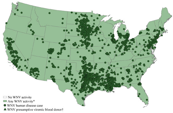
West Nile virus (WNV) activity reported to ArboNET, by state, United States, 2012 (as of September 11, 2012)
The map displays white areas that represent no WNV activity reported, light green areas that represent any WNV activity* , dark green circles that represent disease cases, and dark green triangles that represent presumptive viremic blood donors.
| West Nile Links: viral infection | zoonotic infection | West Nile Virus | PubMed |
Reference
Centers for Disease Control and Prevention, National Center for Emerging and Zoonotic Infectious Diseases (NCEZID), Division of Vector-Borne Diseases (DVBD) West Nile information page viewed 11 September, 2012.
File history
Click on a date/time to view the file as it appeared at that time.
| Date/Time | Thumbnail | Dimensions | User | Comment | |
|---|---|---|---|---|---|
| current | 08:33, 14 September 2012 | | 600 × 392 (48 KB) | Z8600021 (talk | contribs) | ==CDC West Nile Virus September 2012== West Nile virus (WNV) activity reported to ArboNET, by state, United States, 2012 (as of September 11, 2012) The map displays white areas that represent no WNV activity reported, light green areas that represent any |
You cannot overwrite this file.
File usage
The following page uses this file: